Map of Whidbey Island
The clickable areas are those of the Keystone Ferry crossing to Port Townsend, Coupeville home of the red wall, and the southern town of Langley just a short dirve from the Mukilteo Ferry from Washington State mainland.
Hw 3b
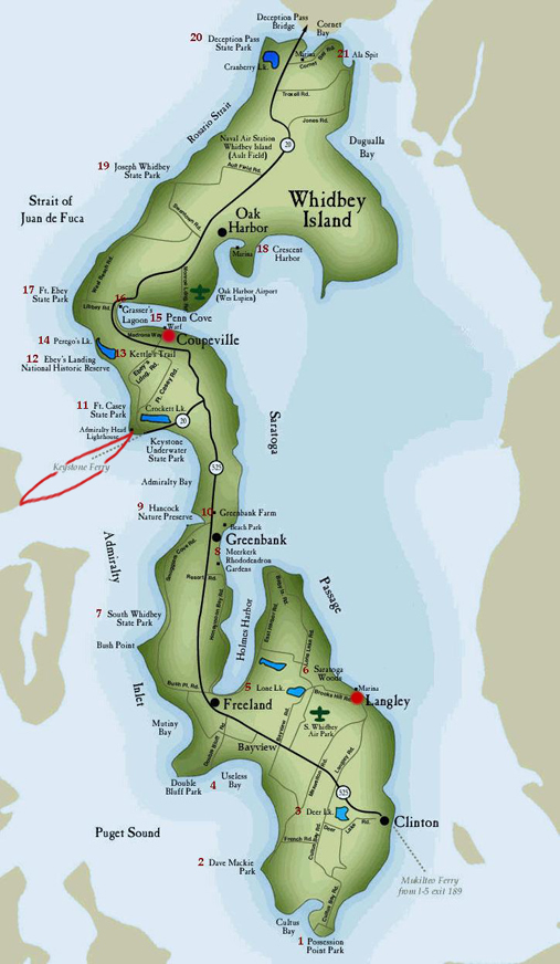
Map of Whidbey Island
The clickable areas are those of the Keystone Ferry crossing to Port Townsend, Coupeville home of the red wall, and the southern town of Langley just a short dirve from the Mukilteo Ferry from Washington State mainland.